Get Complete Project Material File(s) Now! »
Chapter 3 – Study area and data collection
Introduction
In the previous chapter, literature on the existence of the uneven spatial distribution of land in different countries of the world was reviewed. This chapter documents the background of the study area in terms of location, size, climate and the demographic characteristics of the emerging farmers, and the methods and procedures used to achieve the objectives.
In the first section, the focus is on a description of the geographical area of the study. A description is provided of the Limpopo Province and then of the Mopani district, and how it relates to other districts in the province. The methodology and the theoretical framework used in the study is explained in sections three, and four, while the study population and sample procedures are explained in sections five and six. The data collection process, analysis and procedures are discussed in section seven. In section eight, the limitations of the research study and possible measures taken to minimise the negative impact thereof on the project are outlined. It is followed by details of the problems encountered in data collection and analysis. Although some problems were experienced, their impacts were minimal and solutions to that effect were sought to safeguard the integrity of the study.
In this study, the researcher was inspired by the change of government policies and their potential impact on the spatial distribution of the African black emerging farmers in the Mopani district after the dawn of the new democracy in South Africa. Furthermore, it was also motivated by the interest of government in reducing the spatial distribution of economic resources in the country through policy reforms. This emanates from the constitutional mandate that directs all institutions of state to uphold democratic principles in the execution of their duties and responsibilities in promoting equitable service delivery to the country and all its economic sectors and people.
Study area
While South Africa is situated in the southernmost part of Africa, the Limpopo Province is South Africa’s most northern province, as can be seen in Figure 3.1. The Limpopo Province is one of the nine provinces of the Republic of South Africa that came into existence in 1994 after the democratic election. It covers an area of 12.46 million hectares and accounts for 10.2 percent of the total area of the Republic of South Africa (refer to Figures 2.1 and 3.1). A number of former homeland areas are included in the borders of the Limpopo Province (refer to Figure 1.1). The province is bordered by Botswana to the west, Zimbabwe to the north and Mozambique to the east. It is divided into five districts, namely, the Waterberg district, the Vhembe district, the Capricorn district, the Sekhukhune district and the Mopani district (Thomas, 2013).
The Limpopo Province has four distinct climatic regions with the Middle veld, Highveld (semi-arid), Lowveld (arid and semi-arid), and the Escarpment (sub-humid climate with rainfall more than 700 mm per annum) (RSA, 2008). The province has a high climatic variability that requires farmers to have seasonal climate forecast information and projections in advance for them to be able to plan their farming calendar accordingly. According to Maponya (2013), it is a drought-prone province, which faces challenges of drought from time to time. These climatic conditions regularly create problems, not only for the emerging farmers, but also for the commercial farmers in the province (Mpandeli et al. 2015). Due mainly to drought across the Limpopo Province crop production is heavily affected (Mpandeli, 2014). Besides, the province has other physical factors like soil that must be utilised, though not fertile (Odhiambo, 2011). This factor affects emerging farmers’ agricultural activities negatively, especially irrigation due to their lack of credit to supplement their shortage of water by devising alternative irrigation methods that require funding.
In its annual report, the provincial government of the Limpopo Province argues that the province produces up to 60 percent of all fruit, vegetables, maize meal, wheat and cotton. Consequently, the province has become one of South Africa’s richest agricultural areas (Limpopo Province, 2010). The provincial report further indicates that 45 percent of the R2 billion annual turnover of the Johannesburg Fresh Produce Market comes from Limpopo. It also produces 75 percent of South Africa’s mangoes, 60 percent tomatoes and 285 000 tons of potatoes mainly from white farmers such as ZZ2 due to an adequate resource base (Limpopo Province, 2010a). Horticulture remains the mainstay of the province (Michau, 2011).
The Mopani District Municipality is the study area for this research. The district is located in the north-eastern part of the province (See Figure 3.1). The Mopani District Municipality covers an area of 1.14 million hectares (Limpopo Province, 2008; Department of Agriculture, 2008). In terms of relative location, the district is situated about 70 kilometres from Polokwane, the capital city of the Limpopo Province, using the R81 and R71 provincial roads. It is presently part of the political divisions of the RSA, that came into existence in 1994 after the democratic election, covering an area of 12.46 million hectares. This accounts for 10.2 percent of the total area of the Republic of South Africa (RSA, 2008; Oni et al. 2003), (see Figure 3.2).
The district is bordered by Mozambique in the east, by the Vhembe District Municipality (VDM) through the Thulamela and the Makhado District Municipalities (MDM) in the north, the Mpumalanga province through the Ehlanzeni District Municipality (EDM) in the south, the Capricorn District Municipality (CDM) to the west and in the south-west by the Sekhukhune District Municipality (SDM) (Limpopo Province, 2011), (See Figure 3.3).
According to Mopani District Annual Report (2011), there are 16 urban areas (towns and townships), 354 villages (rural settlements) and a total of 125 wards (Mopani District Municipality, 2011a). The main towns are Tzaneen, Hoedspruit, Giyani, Phalaborwa and Modjadjiskloof. The seat of the Mopani District Municipality is Giyani and part of the district is included in the Kruger National Park which forms part of the Great Limpopo Trans-Frontier Park (Limpopo Province, 2011).
The Mopani district is endowed with different development potentials (Thomas, 2013). The development potentials of the district are indicated in Table 3.1. Although the district prides itself on its development potential, the emerging farmers are not sharing in the prosperity of the district. They struggle to sustain their farming activities because of numerous constraints they experience. It impacts negatively on emerging farmers’ productivity and income. The constraints affect them adversely to progress into the mainstream commercial farming sector and to become competitive with other commercial farmers. As a result, they will not be able to market their products locally and nationally. There is, therefore, a need for government intervention to assist in developing emerging farmers through policy support. Despite their constraints the various districts in the province have some development potential.
According to the Integrated Development Programme (IDP) of the Mopani district, the various municipalities are characterised by different potentialities (Limpopo Province, 2008; Mopani District Municipality, 2008). Their potential can be beneficial, given the weather conditions in the district. In terms of climate, the MDM generally has a warm, dry, frost-free and sub-tropical climate with summer rainfall. Its temperature ranges from the minimum of 14 to 17°Celsius, and a maximum average of 28 to 30°Celsius (Limpopo Province, 2008). Formerly, it was known as the Lowveld region that contributed significantly towards the activity of agriculture on the provincial level. These favourable weather conditions can help farmers to be more productive, although the area sometimes experiences drought-related conditions. The farmers can depend on the existing climatic conditions and cultivate the type of crop that will not pose a serious risk. It can assist them in producing not only for subsistence, but also for commercial purposes. Formerly, the district was known as the Lowveld region that contributed significantly towards the activity of agriculture on provincial level. The development potentialities of the different local municipalities in the district are indicated in Table 3.2.
However, the district has further been sub-divided into five local municipalities. The distribution of the population in the district differs from one municipality to the other. According to StatsSA (2007), the population of the Mopani District Municipality was 1068 569 in 2007 and has increased to 1 092 507 in 2011 (StatsSA, 2011b). The census indicates that, out of the entire district population, the majority (81%) reside in rural areas, 14 percent in urban areas and five percent on farms. This shows that the Mopani district is predominantly rural and the population densities vary from one municipality to another, with an average of 23 people per hectare. This further indicates that people are sparsely populated with sufficient land around them that could be utilised for agricultural activities to earn a living. However, the problem of land shortage for economic development is perpetuated by the vast land occupied for dwelling purposes, leaving very little land for economic growth.
The average ratio male to female in the Mopani District Municipality as a whole is 46 percent to 54 percent and these tendencies and trends are still prevalent. In almost all the local municipalities there are more females than males (StatsSA, 2011b). This is most significant in the Greater Giyani and the Greater Letaba municipalities, which are primarily rural/non-urban in nature.
The 2011 Census further shows that the current highest population numbers existed in the age category 15 to 19 years, whereas, in the previous years, the highest was in the category 10 to 14 years. In the age group 20 and above, females out-number males significantly. Population numbers decrease with age increase, which indicates that the older generation is smaller than the young generation. The government’s policy focuses on female and youth, which is in tandem with these trends in the province. However, their problem of a lack of interest in farming, especially among young people, compromises the government’s intension to empower both the youth and females (StatsSA, 2011b). The location of the five district municipalities in relation to one another is shown in Figure 3.4.
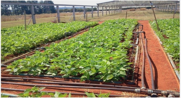
In the Mopani district, most of the rural residents are poor. The settlements in this district are served by emerging farmers with their agricultural produce. Among others, there are economic activities such as mining, government departments and community services in the district while agriculture forms the fourth largest sector in the district. It predominates more in Tzaneen, Maruleng and Letaba although it is also significant in other districts. According to Limpopo Province (2008), the most important irrigation schemes in the region are Lower–Letaba, Blyde Irrigation and Middle Letaba. It has future agricultural potential in subtropical fruit, citrus fruit production and vegetables, but its unutilised land potential is estimated at between 10 000 to 70 000 hectares. According to the Provincial Economic Development Strategy (Limpopo Province, 2010c), 10, 000 hectares of the district’s potential can be brought into production over the next five years, mainly in new orchards in the Letaba/Letsitele basin area with about 1500 hectares in the Klein Letaba area.
It was further indicated by the Annual Performance Plan that a bigger share (50%) of the farm income in the province came from horticulture in the district. Most important crops in terms of monetary value are citrus, vegetables and subtropical fruit (Mnguni, 2010). At least 6,7 percent of the land can be considered arable of which 43 percent is under irrigation, which is by far the most of all districts in the province (Limpopo Province, 2014).
Despite the above-mentioned economic sectors, a notable percentage of people in the district have no income. Income in rural areas is constrained by the rural economy that is unable to provide people with remunerative jobs or self-employment opportunities. According to the Mopani District Annual Performance Report (Limpopo Province, 2010a), the district contains the country’s least developed and poorest communities. The study further shows that in 2006 at least 11 percent of the population live in a state of absolute poverty. Underdevelopment and high inequality have been caused by a concentration of economic power in certain sectors in some regions as compared to others.
In addition, 55 percent of the population in the Greater Tzaneen region, 48 percent in the Greater Letaba region and 46 percent in the Greater Giyani forms part of the most deprived 25 percent of the population in the province while 71 percent of the population of Ba-Phalaborwa region are registered among the least deprived 25 percent of the provincial population (StatsSA, 2011b).
Given the agricultural potential of the district, the introduction of the new policy intervention in agriculture is likely to benefit emerging farmers if properly implemented and appropriately resourced. The previous agricultural policy has impacted negatively on the spatial distribution of farming in the district, which has resulted in many problems and challenges for emerging farmers (StatsSA, 2011b). This forms the basis of the investigation and focuses specifically on emerging farmers’ distribution and development in this district.
Conceptual framework
To analyse these complex variables, the post-modern theory is used in the research. Theorists use cultural, physical, social, economic and political components to explain societal patterns in different parts of the world to constitute worldviews as part of social research (Venkatesh, 1999; Pieterse, 2010; Punch, 2011; Rogers, 2011). However, different worldviews exist which cannot be fitted ina single conceptual framework. According to Venkatesh (1999), the term that has been used to capture the conditions of the current worldview, is postmodernism which describes the different social, economic and political developments that follow modernity. It is against this background that this thesis focuses on the postmodernism framework. This post-modern theory will be pursued to ensure that policy-making is enhanced by a more economic, social, political and culturally informed framework (Jehlicka & Smith, 2011) within the emerging farming sector. This will bring with it issues concerning the impact of policy on spatial distribution of farmers in different areas under varying conditions that assist in the construction of the geographic knowledge on farming (Saitluang, 2013).
Regarding modernity, there are different views about its meaning and origin. It is defined by postmodernist as a particular view of the contemporary social world and its ongoing rapid transformations and it is not restricted to the recent and current time period (Johnson, 2008). Some of the notable features of modernity include progress, use of technology and class-based social structure that believes in the principle of an objective reality, the rejection of mysticism, a universal system of knowledge and truth, reason and individualism (Midmore, 1996; Venkatesh, 1999; Cembalo, Milgliore, & Schifani, 2015).
According to Sellamna (1999), the rise of the modernist theory is associated with technological and industrial achievements of the post-war period (Adelman & Yeldan, 1999). The term refers to the time in Western history since the dawn of the Age of Enlightenment. As a result, the modernist approach is viewed as the processes and changes that have occurred since the Industrial Revolution to transform the traditional, social, political, economic and culture of the pre-modern worldview (Sellamna, 1999; Andykalan, 2012).
Modernism emphasises order in social, economic and political systems, and has sought theories and generalisations to explain the complexities of human life. Historically, as more changes occur, challenges in life emerge. The social, economic and cultural problems of the seventies changed perceptions and led to disillusionment with the modernist theory (Sellamna, 1999; Adelman & Yeldan, 1999). The end of the social, economic and political trends in various spheres of life in history have signalled the end of the period of modernity, which has long been characterised and largely defined by scientific advance, industrialism, capitalism, urbanism and bureaucracy (Bauman, 2000). It has resultantly marked the dawn of the post-modern theory.
Contrary to modernity, post-modern theory represents a reaction to the disillusionment that sets in when developments in the social world no longer conformed to intellectuals’ idealistic faith in reason as a foundation for continued progress (Johnson, 2008). While Saitluang (2013) argues that it has first emerged in the fields of architecture and literary theory, and then incorporated into social sciences afterwards, Puja (2015) alleges that it seems to have been used first in 1917 by Rudolf Pannwitz to describe Western culture and resurfaced in 1934 to refer to the backlash against the literary modernism by Ferderico de Onis.
The origin of postmodernism is a matter of some great controversy that cannot be traced to a single source or a set of conditions in time and place. On the one hand, the origin of postmodernism is traced back from the sixties with the use of postmodern architecture World War II, which is the radical break from modernity (Englehart, 1997; Andykalan, 2012). Although it is not clear whether postmodernism is a break-away from modernism or its continuation, the theory has been chosen as a tool that is in line with the dawn of the global village (Stewart & Zaaiman, 2014) that represents the post-industrial age in which emerging farmers operate.
Thus, postmodernism has been described as post-paradigm and refuting the necessity for theory building. In furthering this view, Corbin and Strauss (2015) regard the theory as a mere tool and not a set of directives that helps analysts to carry out axial coding around a category. The theory emphasises its significance and reference in this thesis, especially in this age in which ownership of wealth and resources should no longer be the monopoly of a chosen few but be widely dispersed among numerous stakeholders where capitalism is transformed into post-capitalism (Johnson, 2008).
Chapter 1 – Introduction and background
1.1 Introduction 1
1.2 Background to the study
1.3. Policy implementation
1.4 The research problem
1.5 The aim and objectives of the research
1.6 Research design
1.7 Rationale
1.8 The contribution of the study
1.9 Reliability and validity
1.10 Organisation of the study
1.11 Conclusion
Chapter 2 – Literature review
2.1 Introduction
2.2 Aims of agricultural policy implementation
2.3 The institutional policy framework in agriculture
2.4 Global perspective on policy implementation
2.5 African context: the colonial era in Africa
2.6 The South African context
2.7 Transport and emerging farmers
2.8 Conclusion
Chapter 3 – Study area and data collection
3.1 Introduction
3.2 Study area
3.3 Conceptual framework
3.4 Methodology
3.5 The study population
3.6 The study sample
3.7 Data collection
3.8 Data analysis
3.9 Limitations
3.10 Problems encountered in data collection and analysis
3.11 Conclusion
Chapter 4 – Presentation of findings
4.1 Introduction
4.2 Responses of emerging farmers
4.3 Responses of municipality officials
4.4 Responses of provincial officials
4.5 Conclusion
Chapter 5 – Analysis and interpretation of data
5.1 Introduction
5.2 Background for analysis
5.3 The spatial pattern of the emerging farming sector in the Mopani district
5.4 The influence of policy on the distribution of emerging farmers
5.5 Policy and the changing agricultural landscape
5.6 Contribution of policy towards a more even spatial distribution of emerging farmers
5.7 Conclusion
Chapter 6 – Summary and conclusions
6.1 Introduction
6.2 Main conclusions
6.3 Interpretation of findings
6.4 Implication of findings .
6.5 Implications for policy and research
6.6 Conclusion
GET THE COMPLETE PROJECT
THE IMPACT OF THE IMPLEMENTATION OF GOVERNMENT POLICY ON THE SPATIAL DISTRIBUTION OF EMERGING FARMERS IN THE MOPANI DISTRICT IN THE LIMPOPO PROVINCE OF SOUTH AFRICA