Get Complete Project Material File(s) Now! »
CHAPTER 3 DEMARCATION
Chapter three consist of brief discussion about the study area which is the Free State Province. Areas such as geography, districts, people, industrial sector, mining sector and agriculture sector were touched.
THE FREE STATE PROVINCE
Geography
In terms of geographical distribution, the Free State Province which is one of nine provinces in South Africa (see Fig. 3.1) is centrally located; it represents 10.6 percent of the total land area of the country. The Province covers an area 129,464 square kilometres and according to the national estimated population of 2007, it has a population of 2.77 million (Statistic South Africa, 2007).
The Free State is situated on the flat vast plains in the centre of South Africa; Free State Province borders six other provinces with the exception of the Northern Province and Western Cape. Internationally it shares boundary with Lesotho on the east, it is bordered by the Orange Vaal River on the south, while the north-eastern boundary is formed by the Klip River.
DISTRICTS OF THE FREE-STATE PROVINCE
The Free State Province consists of five main areas which can be distinguished as shown in Figure 3.2
The Xariep District
The Xariep District is a dry region of the Free State Province with extensive farming which consist mainly sheep and small towns. The district comprises open grasslands; the southern bordered by the Orange River called Gariep by the indigenous Khoikhoi people. This dam is one of major tourist attractions which offer variety of accommodation and leisure facilities which is centred on water.
The Motheo District
Motheo in Sesotho word means ‘foundation of string base of building’. The largest population in this district is found in the Bloemfontein which is the economical and industrial heart of the.
Province; it is also the most urban centre. The district mainly comprises of an open grass field with mountains in the eastern most part. The Motheo District Municipality (see Figure 3.3) consists of three local municipalities which are:
Mangaung Local Municipality
Mantsopa Local Municipality
Naledi Local Municipality
Mangaung local municipality
The Mangaung Local Municipality consists of Bloemfontein which is known as the “city of Roses”. It is the sixth largest city in South Afric a and capital of the Free State Province, while forming inter alia the cultural, tertiary educational and shopping hub of the province.
Also from a historical point of view, Bloemfontein/Mangaung ranks very highly, while it houses the seat of the Appeal Court which makes it the judicial capital of South Africa, Bloemfontein’s central location makes it ideal for the holding of conferences, as the city disposes a wide range of entertainment, recreational and sporting facilities.
Botshabelo which is also found in the Mangaung local district is located 55 kilometres from Bloemfontein, with a population of approximately 5000,000 people; it is the largest township development in The Free State and one of the largest in South Africa. Botshabelo consists of an industrial park with factories and infrastructure worth 500 million Rands.
Thaba ‘Nchu within which the study was carried out (highlighted in red in Figure 3.4); is another area which is highly dominated by black emerging farmers, it is situated 12 kilometres from Botshabelo. This town has vibrant retail shopping facilities, a luxury hotel and casino and other cultural amenities. At Thaba ‘Nchu, industrial development is coming on stream.
Mantsopa local municipality
It comprises of towns of Ladybrand, Hobhouse, Excelsior, Tweespruit and Thaba Phatswa. The area is traversed by the Maluti Route on R26 from Kwazulu Natal via the Eastern Free State, up to the Eastern Cape highlands and the Lesotho Kingdom. Ladybrand is an economically busy town with high property prices and sometimes being popularly referred to as the “capital” of Lesotho.
Naledi local municipality
It encompasses towns such as Dewesdorp, Wepener and Vanstadensrus and stretches along the Highlands of the Maluti Route. The R26 Route links the Naledi areas/towns together.
The Thabo Mofutsanyane District
This district has beautiful hills and fruit farms; it forms the eastern part of the province and borders the Kingdom of Lesotho and Kwa-Zulu Natal. The district is one of the most important tourist destinations in the Free State mainly because of the spectacular beauty of the Drakensberg and Maluti mountain ranges.
The Northern Free State District/ Fezile Dabi
This is an important agricultural production area, particularly for maize. It is known as “the grain basket” of South Africa. It consists of the V aal Dam which is the main source of water for Gauteng; it also offers a wide range of sport and leisure facilities. The district also consists of the Vredefort Dome which is the third largest meteorite site in the world (20km in diameter).
The Lejweleputswa District
This district is the major contributor to the Free State Gross Domestic Product (GDP), and also an important agricultural area. The district is predominantly known for Free State Goldfields, which forms part of the larger Witwatersrand basin.
The economy of the area is built around gold mining industry, followed by maize production. Bothaville is considered one of the most important maize centres in South Africa and also forms part of the Free State Maize Route. The annual NAMPO Harvest Farm and Festival attracts more than 20000 visitors and is the second largest private agricultural show centre in the world.
AGRICULTURAL SECTOR
The western part of the province consists of plains, the eastern part is mountainous. The Free State is almost treeless, consisting mainly of grasslands with some Karoo vegetation in the south. The soil is rich and climate good, allowing a thriving agricultural industry. The Free State is a summer-rainfall region and is extremely cold during winter months, especially towards the eastern mountainous regions where temperatures could be as low as – 9 degree Celsius. The western and southern areas of the Province are semi-desert. The mean annual rainfall is 532mm.
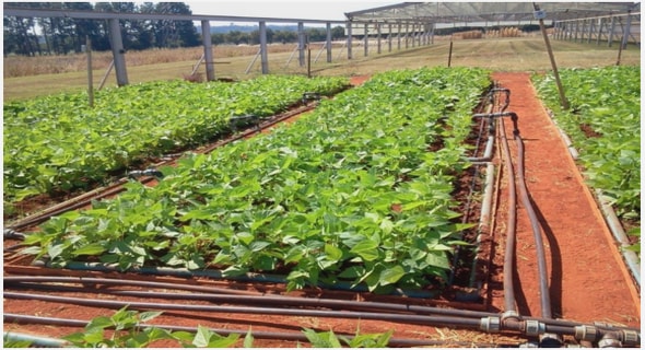
Cultivated land in the Free State covers 3.2 million ha, on the other hand natural veld and grazing land covers about 8.7 million ha. Two third of gross agricultural income in the Free State comes from field crops. Animal products contribute about 30 per cent while horticulture makes up for the balance.
Soya, sorghum, sunflowers and wheat are cultivated in the Eastern Free State; largest percentage of cherry crop is produced in Ficksburg district while about 40 per cent of the country’s potato production comes from the high-lying areas of the Free State. The main vegetable crop is both white and green varieties of asparagus, the Province also export about 1.2 million tons of cut flowers a year (South Africa.info reporter, 2007).
INDUSTRIAL SECTOR
The Free State economy has moved from dependence on primary sectors such as mining and agriculture to an economy increasingly oriented to manufacturing (South AfricaInforeporter, 2007). About 14 per cent of the province’s manufacturing is classified as being in high-technology industries, northern Free State chemical sector is one of the most important in the southern hemisphere, while Sasol which is a world leader in production of fuels, waxes, chemicals and low-cost feedstock from coal is based in Sasolburg area of the Free State Province.
MINING SECTOR
The Free State contributes about 16.5 per cent of South Africa’s total mineral output. The major employer in the Free State Province is the mining industry and is responsible for some 22.3 per cent of GDP of the Province. A gold reef over 400 kilometres long, known as the goldfield region stretches across Gauteng and the Free State. The largest gold-mining complex is Free State Consolidated Goldfields, with an area of 330 square kilometres.
There are 12 goldmines in the province which produces about 30 per cent of South Africa’s output and making it the fifth largest producer in the world. Gold mines in the Free State also supply a substantial portion of the total silver produced in the country, also uranium, diamond, bentonite and bituminous coal which is converted to petrochemicals at Sasolburg is mined in the Province.
CONCLUSION
This chapter reviewed the study area which was Thaba ‘Nchu found under Mangaung Local Municipality of Motheo District of the Free State Province. Most of the information in this chapter was found on South Africa info reporter (www.southafrica.info), the official website of the Motheo District Municipality (www.motheo.com) as well as the Provincial government’s website ( www.fs.gov.za/index.htm).
METHODOLOGY
In this chapter, the methods and tools used for data collections were discussed.
AIMS AND OBJECTIVES
Aims
The primary aim of the research was to study drought coping mechanisms exhibited by farmers by investigating their actions and inactions before and during a drought.
Objectives
The aims of this research were addressed through investigating the following objectives which are to:
Investigate farmers’ the strategies in response to disturbances and changes during drought
Determine the differences between all the coping strategies adopted by different farming families
Identify the effect of drought and coping mechanisms adopted by farmers on their family during the process.
METHODS
To achieve these set aims and objectives of the study, eight (8) villages were selected from Thaba‘Nchu of Mangaung local municipality and its environs (see Figure 4.1), and the selection were based on the fact that they suffer from drought and other associated effects from time to time, it should also be noted that these areas represents other communities with similar characteristics which makes the findings of the present study applicable to such areas. According to the field extension workers in Motheo District, Thaba‘Nchu consists of basically small scale farmers.
Different perspectives of farming families about drought were obtained with the use of questionnaire, aspects such as human demography, farmers understanding about drought,effect and response of drought on the livestock heard and crops, drought effects on farmers and their households, as well as their strategies in response to disturbances and changes during drought were all considered.
Population and Sample size
Small-scale farmers were basically targeted for this survey, and they are regarded as farmers operating on a farm land less than ten hectares irrespective of their gender. These farmers were either crop famers, livestock farmers or mixed farmers. The primary sampling unit was the individual household. This consists of 200 randomly selected farming households. For the purpose of this study, a household is a group of people in a housing unit living together as a family and sharing the same kitchen. The household head represented his or her household members as the respondent for this survey. The head of the household is defined as the person making major economic, social and household decisions irrespective of age and gender.
Sampling tool
The questionnaire which is an often used observational piece of equipment to gather personal data and opinion according to Hopkins et al. (1990) was use for this study. It offers a way to collect personal information from subjects that may not readily be obtainable using other methods. According to Krathwohl, (1993), questionnaires provide structured responses and as a result must be carefully developed and revised to obtain valid data.
The role of questionnaire
Bryman and Bell (2007) and Hague (1993) described questionnaire as a vehicle by which people are interviewed, it provides the interviewer a form or medium upon which to record answers, without a questionnaire there is no structure for an interview. Hague (1993) gave four purposes of questionnaire which were taken into consideration while selecting the medium for data collection; to draw accurate information from the respondents and this is obtained by asking the right question to the right person, it provides a structure to the interviewer so that it flows smoothly and orderly, it provides a standard format on which facts, comments and attitudes can be recorded and lastly it facilitates data processing.
Types of questionnaire
There are three recognised different types of interview situations by researchers, which in turn require three different types of questionnaires (Hague 1993):
Structured questionnaire
In structured questionnaires, the researcher set out precisely the wording of the questions and order in which they will be asked. Most of the questions have pre-defined answers and there will be little latitude for a respondent to stray beyond them. Structured questionnaires are the bedrock of large quantitative surveys; it could be telephonic, face-to-face or self completion.
Semi-structured questionnaire
This type of interview uses questionnaires with a mixture of questions with predefined answers as well as those where the respondent is free to say whatever is liked. In each interview the question are asked in the same way and there may be hundreds of interviewees in the whole survey. The semi-structured questionnaire is a more flexible tool than its highly structured counterpart and there is likely to be more probing to find out reasons for certain actions. This type of questionnaire was used for the data collection for this study.
Unstructured questionnaire
In this type of informal or in-depth interview, the researcher uses a checklist of questions rather than a formal questionnaire on which answers are written down. There is considerable latitude allowed on the part of the interviewer and different channels of questioning are selected during the interview itself. The interview is often recorded on tape.
Whether the researcher uses a structured, semi-structured or unstructured questionnaire depends on the number of people to be interviewed, what type of people they are, the type of information to be collected and the type of interviewers who will be administering the questions. The method of data analysis also has an influence, though in itself this is influenced by the size of the survey and the type of information collected.
Questionnaire as a research instrument
Questionnaires are used by researchers as instrument to convert the information directly given to a person who is the subject into data. It provides access to what the subject knows, i.e. it makes it possible to measure what a person thinks or knows, likes or dislikes about a particular issue. The use of questionnaire is a way of getting data or information about persons by asking them rather than watching them behave or by sampling a bit of behaviour; as a result, self report poses certain problems such as; cooperation from respondents while completing the questionnaire, also there is need for respondents to tell what is, rather than what they think should be, or what the researcher want to hear, lastly respondents must know what they feel or think in order to report it(Hague 1993).
According to Maraj (2000) the questionnaire has certain advantages which were taken into consideration when it was selected as research instrument, the advantages include cost consideration i.e. the questionnaires could be hand delivered to respondents and collected instead of postage, it produces quick results, when it is not difficult to contact respondents, it is a convenient method of data collection, there is a good assurance for anonymity, also the questionnaire is ideal for a stable, consistent and uniform measure without variation as well as the fact that it covers a wider range of issues.
During the compilation of the questionnaire, certain guidelines listed by Cox, (1996) were also considered, these include; use of simple sentence structure, avoiding the use of uncommon terms or languages, word or phrase with unclear or uncertain meaning, avoid asking respondents’ opinion on a subject they cannot be expected to know anything about, as well as to avoid writing compound question or phrases.
TABLE OF CONTENTS
TITTLE PAGE
DECLARATION
ABSTRACT
ACKNOWLEDGEMENT
TABLE OF CONTENT
CHAPTER 1: RESEARCH BACKGROUND
1.1 INTRODUCTION
1.2 MOTIVATION
1.3 PROBLEMS STATEMENT
1.4 THE HYPOTHESIS
1.5 AIMS AND OBJECTIVES
1.6 SCOPE OF THE STUDY
1.7 LIMITATIONS OF THE STUDY
1.8 STRUCTURE AND PRESENTATION OF THE STUDY
CHAPTER 2: LITERATURE REVIEW
2.1 THE CONCEPT OF DROUGHT
2.2 DEFINITION OF DROUGHT
2.3 DROUGHT IMPACTS AND RESPONSES
2.4 COPING AND VULNERABILITY WITH DROUGHT
2.5 WATER ISSUES IN SOUTH AFRICA
2.6 PLANNING FOR DROUGHT
2.7 ROLE OF EARLY WARNING SYSTEM IN SOUTH AFRICA
2.8 DROUGHT INDICES
2.9 DROUGHT INDICES USED IN SOUTH AFRICA
2.10 CONCLUSION
CHAPTER 3: DEMARCATION
3.1 THE FREE STATE PROVINCE
3.2 DISTRICTS OF THE FREE-STATE PROVINCE
3.3 AGRICULTURAL SECTOR
3.4 INDUSTRIAL SECTOR
3.5 MINING SECTOR
3.6 CONCLUSION
CHAPTER 4: METHODOLOGY
4.1 AIMS AND OBJECTIVES
4.2 METHODS
4.3 CONCLUSION
CHAPTER 5: DATA ANALYSIS AND INTERPRETATION
5.1 INTRODUCTION
5.2 DATA ANALYSIS AND INTERPRETATION
CHAPTER 6: CONCLUSIONS AND RECOMMENDATIONS
6.1 FINDINGS AND CONCLUSIONS
6.2 RECOMMENDATIONS
GET THE COMPLETE PROJECT
DROUGHT COPING MECHANISMS: A CASE STUDY OF SMALL SCALE FARMERS IN MOTHEO DISTRICT OF THE FREE STATE PROVINCE