Get Complete Project Material File(s) Now! »
CHAPTER THREE RESEARCH DESIGN AND METHODOLOGY
Introduction
The chapter deals with the design and methodology that was used for this study. The research methodology consisted of a desktop study and actual fieldwork survey for investigation and data collection. Prior to the commencement of baseline ecological data gathering in the field, consultation visits were carried out to the traditional rulers in the study area.
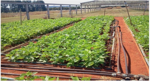
The Local Government Areas (L.G.As) selected for data gathering and socioeconomic survey were Makurdi, Tarka and Gboko (Figure 1.1) based on criteria of centrality, population size, road access, farming population, availability of farming cooperative societies, preponderance of rice, yam, and cassava farmers, and proximity to the River Benue and River Katsina Ala. Secondary data from academic journal articles on other areas of the Lower River Benue Basin were sourced to compare and support field data results.
The fieldwork surveys involved stratified sampling and field observation through rapid appraisal. The details of materials and methodology adopted for data collection, analyses and production of necessary maps are provided in this chapter.
Research proposal and ethics approval
A research proposal to carry out this study was prepared and submitted to the College of Agricultural and Environmental Sciences of the University of South Africa. Upon approval, an ethics application form for this research was submitted to the Ethics Review Committee of the College of Agricultural and Environmental Sciences for consideration and approval. After the ethics application review meeting, ethics approval was given for the duration of the research with reference number 2014/CAES/059. The research proposal and ethics approval letters are attached in Appendix 1.
Consultations with traditional leaders and relevant authorities
Consultations for this research began with the traditional leaders within the study area. Meetings were held with the traditional leaders of two of the three Local Government Areas which formed a major part of the study area within the Lower River Benue Basin (Makurdi, Tarka, and Gboko). The traditional leaders consulted for this research are the Ter Makurdi II Chairman, Makurdi Local Government Traditional Council, and Ter Mbakor, Tarka Local Government Traditional Council. After careful consideration of the purpose and importance of the study, letters of approval were obtained from the traditional rulers (Appendix 2). The traditional leaders also sent prior messages to other traditional heads within their influence of authority.
In other to obtain the approval of the government environmental agency in charge of the study area, the Benue State Environmental Sanitation Agency was approached. Approval for this research by the Agency was conveyed in a letter attached in Appendix 3. Other government institutions consulted for information to aid data analyses included Lower Benue River Basin Authority, Benue State Ministry of Lands and Survey, Benue State Ministry of Agriculture, Benue State Library, National Hydrological Service Agency, Nigerian Inland Waterways Authority, Nigerian Geological Survey Agency, and the Nigerian Meteorological Agency.
Types of data sets
The study utilised both primary and secondary data. Primary data comprised biophysical and socioeconomic data collected from the field through sampling, rapid appraisal and observation. Secondary data included satellite imagery, collateral maps on topography, permissible limits for soil data, relevant literature from academic journals, hydrologic and climatic data.
Collection of biophysical data and analysis methods
Soil data
The essence of soil analysis in this study was to ground truth soil results for remote sensing analysis carried out on satellite imagery of the study area. The soil results also supported the process of drawing up conclusions and recommendations for this study. Soil samples were collected through stratified random sampling from cassava, rice and yam farms in Makurdi, Tarka, and Gboko. These farms belonged to farmers who are members of farming cooperative societies in Makurdi, Tarka and Gboko L.G.As within the study area. This was to ensure the findings of the study have a targeted effect on these cooperative societies.
A total of 36 soil samples were collected from the selected farms in Makurdi (12 samples), Tarka (12 samples), and Gboko (12 samples). In each of the Local Government Areas, 2 samples each were taken in large rice, cassava, and yams farms which were triangulated with consideration for areas of similar topography, management history and crop performance. In each farm, sample points were at least 250 metres apart. The depth of sampling was from 0-30 centimetres (cm) since it was for agricultural land evaluation purposes. At each sampling point, surface (0 – 15cm) and subsurface (15 – 30cm) soil samples were collected. Secondary data of soils from Otukpo,Ohimini, Katsina Ala, Gboko (Benue Cement Company area), and Bassa (Kogi State) from journal publications was used to support the results of samples collected and analysed. A handheld Global Positioning System (GPS) device, Garmin 12 XL series with accuracy of between 15 to 20 metres, was used to document the coordinates of all sampling points.
The soil samples were collected using a standard metal soil auger and were stored in foil papers and black polythene bags and labelled appropriately. The samples were transported to the Soil Science Laboratory in the Federal University of Calabar, Cross River State, for further physical and chemical analyses. The laboratory agreement letter is attached in Appendix 4.
Chemical tests
The pH of soil was measured using the soil/water ratio of 1:2 method of the International Institute of Tropical Agriculture (IITA, 1979). Soil organic carbon was determined using the method of Walkley and Black (1934). Total nitrogen was determined by the micro-Kjeldahl digestion method (Jackson, 1962) while available phosphorus was determined using the Bray and Kurtz (1945) No. 1 method. Exchangeable bases (Ca, Mg K and Na) were extracted from ammonium acetate buffered at pH 7 (neutral IM NH4OAc, pH 7.0), flame photometry, and versenate EDTA titration method as prescribed in Jackson (1962) and IITA (1979). The effective cation exchange capacity (CEC) was determined through the summation of exchangeable bases. Micronutrients in the soils (Fe, Mn, Ni, V, Co, and Mo) were extracted by digesting the samples with a mixture of concentrated nitric acid (HNO3) and hydrogen chloride (HCI) and their concentrations determined by Atomic Absorption Spectrophotometry (AAS) method – Buck Scientific 200A flame atomisation prescribed by Barnhisel and Bertsch (1982).
Quality assurance was guaranteed by laboratory officers through double determinations and use of blanks for correction of background. The unit of measurement for exchangeable elements was centimoles of positive charge per kilogram (cmolkg-1) while other elements such as phosphorus and micronutrient were measured at milligrams per kilogram (mgkg-1).
CHAPTER ONE: INTRODUCTION
1.0 Introduction1
1.1 Statement of the problem
1.2 Rationale for the study
1.3 Aim and objectives of the study
1.4 Study area
1.5 Agriculture in Nigeria
CHAPTER TWO: REVIEW OF LITERATURE
2.0 Introduction
2.1 Theoretical framework for agricultural land use evaluation
2.2 Sustainable agriculture
2.3 Land evaluation for agriculture
2.4 Climate change and agriculture
2.5 Effects of population growth, increased income, and HIV/AIDS on agriculture
2.6 Summary
CHAPTER THREE: RESEARCH DESIGN AND METHODOLOGY
3.0 Introduction
3.1 Research proposal and ethics approval
3.2 Consultations with traditional leaders and relevant authorities
3.3 Types of datasets
3.4 Collection of biophysical data and analysis methods
3.5 Socioeconomic survey
3.6 Methodology for Remote Sensing and GIS analyses
3.7 Methodology for potential impact assessment
3.8 Agricultural suitability index (ASI) modelling
3.9 Climate change adaptive capacity index modelling
CHAPTER FOUR: BIOPHYSICAL ANALYSIS, LAND EVALUATION AND CROP SUITABILTY ASSESSMENT
4.0 Introduction
4.1 Climatological characteristics of the Lower River Benue Basin
4.2. Drainage characteristics of Lower River Benue Basin17
4.3. Properties of soil in the Lower River Benue Basin
4.4 Results of Remote Sensing and GIS analyses
CHAPTER FIVE: SOCIOECONOMIC SURVEY OF FARMERS AND POTENTIAL IMPACTS ON AGRICULTURAL PRODUCTION IN THE LOWER RIVER BENUE BASIN
5.0 Introduction
5.1. Population size and growth
5.2 Demographic structure
5.3 Farm management practices
5.4 Available infrastructure
5.5 Knowledge of HIV/AIDS and climate change.
5.6 Results of analysis of socioeconomic factors.
5.7 Potential impact of Climate change and population dynamics on agricultural
production in the Lower River Benue Basin
5.8 Potential impact evaluation
5.9 Agricultural suitability index (ASI) of the study area
5.10 Adaptive capacity index of the study area
CHAPTER SIX: CONCLUSION
6.0 Introduction
6.1 Conclusions
6.2 Proposed mitigation strategies for potential impacts
6.3 Limitations of the study
6.4 Contribution to knowledge by the study and areas of further research
GET THE COMPLETE PROJECT
An application of GIS and remote sensing for land use evaluation and suitability mapping for yam, cassava, and rice in the Lower River Benue Basin, Nigeria